Toa Alta, Puerto Rico
(TO-ah AHL-tah)
Toa Alta is known as La Cuna de Poetas (birthplace of poets). Toa Alta was founded in 1751.
Toa Alta is located in the nothern coast of the island, north of Naranjito; south of Dorado and Toa Baja; east of Vega Alta and Corozal; and west of Bayamón.
There are many well-known toalteños, among them: former Miss Universe Dayanara Torres.
Toa Alta is made up of 10 barrios (wards/districts):
- Contorno
- Galateo
- Mucarabones
- Ortiz
- Piñas
- Pueblo
- Quebrada Arenas
- Quebrada Cruz
- Río Lajas
Festivals and Events
- Fiestas Patronales de San Fernando - May
Every year, Toa Alta celebrates a patron saint festival. The festivities include dances, food, parades and religious processions. (787) 870-2100
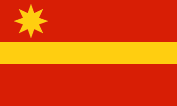
Symbols
Anthem: Cuna de historia y de grandes poetas
Education
There are 19 public schools in Toa Alta, education is handled by the Puerto Rico Department of Education.
Climate
10 Day Forecast from weather.com
Demographics *
Population
66,852
Land Area: 27.02 sq mi
Density: 2,501 per sq mi
Median Age: 40.4
Sex: 53% female
Economics **
$14,408
Median household income: $27,626
Puerto Rico: $21,058
Persons below poverty line: 31.1%
Housing, families and educational attainment *
Number of households
22,413
Housing units density:
999.5 (2013)
Persons per household: 3.22
High school grad or higher: 82.6%
Marital status: 35% married
* U.S. Census Bureau 2020 data, unless otherwise noted - Source: Quick Facts Puerto Rico.
** U.S. Census Bureau 2016-2020
Map References
Coordinates: 18.3883° N, 66.2483° W
ZIP Code: 00953, 00954
Driving Distance from San Juan: 24.5 miles
Driving Time: 42 minutes
Did You Know?
More than 360 million people around the world speak Spanish.


All content included on this website, is not public domain material. The content is the intellectual property of Magaly Rivera or her content providers. Any duplication or distribution of the information contained herein is prohibited without express written permission.
Designed & Developed by Pencils and Pixels