Aguada, Puerto Rico
(ah-GWAH-dah)
Aguada was founded in 1510 with the name of Villa de Sotomayor by Cristóbal de Sotomayor, and under orders from Juan Ponce de León. Since then, Aguada is known as La Villa de Sotomayor (Sotomayor's village).
The city is also known as La Ciudad Del Descubrimiento, as it is popularly held that Christopher Columbus landed in Aguada when he discovered Puerto Rico in November 1493. Aguadilla also makes this claim. While there is no specific historical proof, it is known that many of the first attempts to set up a town on the island were in Aguada.
Aguada became a stopover point for ships on their way to Spain from South America. On 1737, the King of Spain declared that all mail on route to Venezuela and other South America countries from Puerto Rico must exit from Aguada's ports, leading to the area's economic growth.
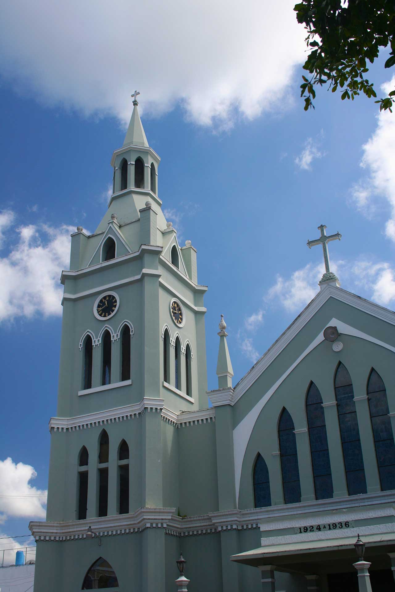
The San Francisco de Asis Church is considered one of the most beautiful religious structures in Puerto Rico. It's construction began in 1924 and it was completed in 1936. The present building was built in the same place as the old church, which dated back to the 1800s and was destroyed during the earthquake of October 11, of 1918. Mass held daily. Visiting hours Mon-Fri 6:30am-11am, (tel. 787-868-2630).
The Museo de Aguada is located in a former railroad station building. Visitors can browse through an interesting array of relics of early Puerto Rico settlers, including some from the Taíno indian precolonization times. Reservations required. Open Mon-Fri 8am-noon, (tel. 787-868-6300).
Points of Interest and Landmarks
Other places worth exploring include:
- Casa Alcaldia de Aguada - Built in 1929
- Central Coloso - The oldest sugar cane processing plants that still in operation in Puerto Rico.
- Centro de Bellas Artes Juan L. Arroyo, (tel. 787-868-6242)
- Ermita Espinar Ruins - A former railroad station building is home of an interesting array of relics of early Puerto Rico settlers, including some from the Taino Indian precolonization times. Mon-Fri 8am-noon, (tel. 787-868-3960) Reservations required.
- Pico de Piedra Beach
- Plaza de Recreo de Aguada
Geography
Aguada is located in the Costal Valley of the West region, just five minutes from Aguadilla and twenty minutes from Mayagüez. Bordering the Atlantic Ocean, west of Rincón west of Aguadilla and Moca; and north to Añasco. The town is bathed by many rivers including Culebrinas, Cañas, Madre Vieja, Grande, Guayabo, Culebra, and Ingenio.
Aguada is made up of 18 barrios (wards/districts):
- Asomante
- Atalaya
- Carrizal
- Cerro Gordo
- Cruces
- Guanábano
- Espinar
- Guaniquilla
- Guayabo
- Jagüey
- Laguna
- Mal Paso
- Mamey
- Marías
- Naranjo
- Piedras Blancas
- Pueblo
- Río Grande
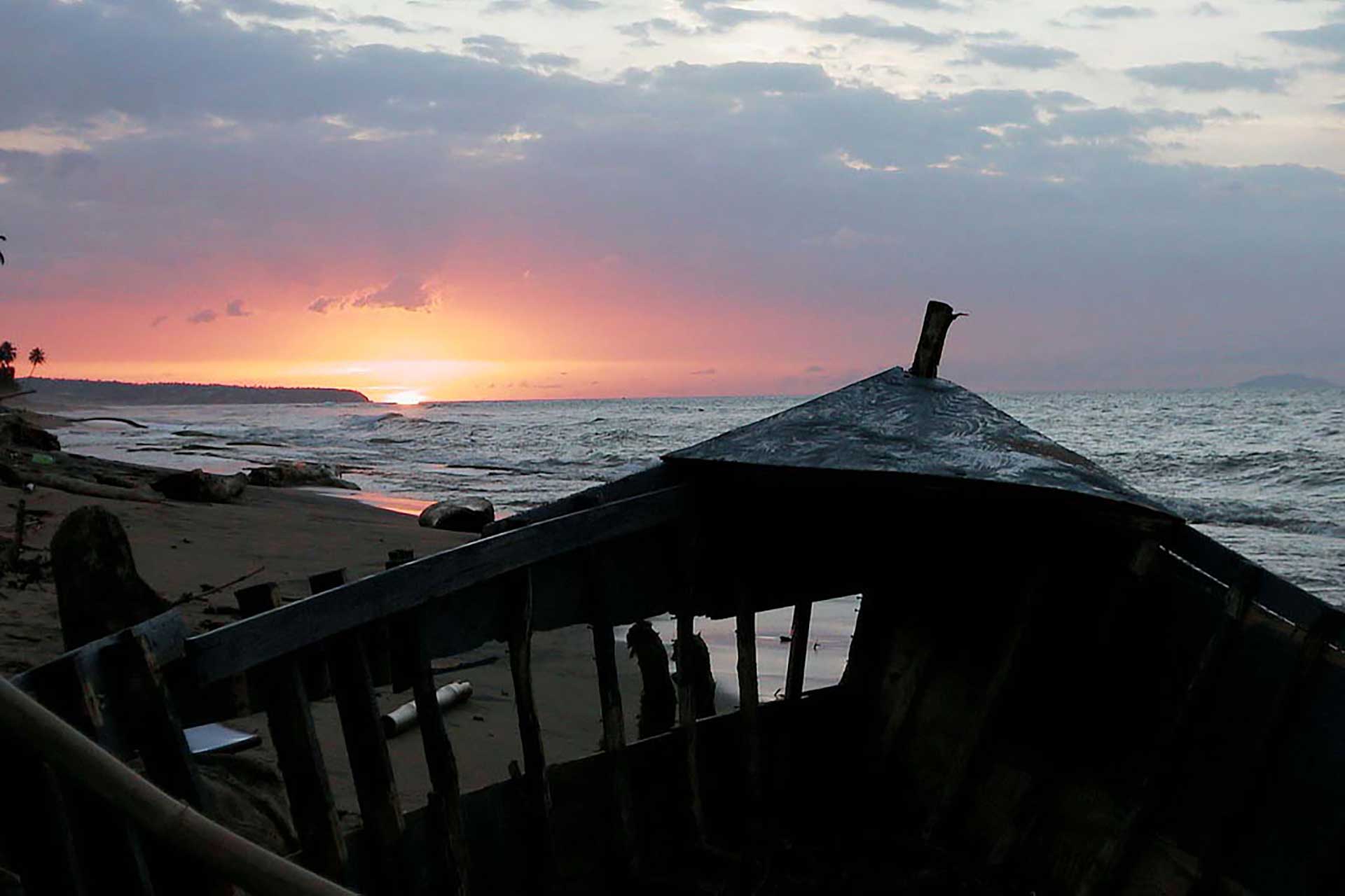
Photo: Rafael Casanas
Climate
Aguada annual precipitation is 89.88 inches, and its average temperature is 80.3°F. Summers are warm (84°-85°F) in the daytime and mild at night time (60°-63°F). Meanwhile winters are moderately warm with cool temperatures at night, temperatures are between in the 60 °F and 70 °F range. The highest recorded temperature was 99°F in 1924. The lowest recorded temperature was 47°F in 1959.
AGUADA WEATHER10 Day Forecast from weather.com
Notable People
There are many well-known "aguadeños", among them:
- Juan B. Arrílloga Roqué, politician
- Ismael Miranda, Salsa singer
- Juan B. Soto, philosopher
Restaurants
- Buena Mesa (Vegetarian), (787) 252-1158
- Casa Juan Restaurant (International), (787) 868-5278
- El Galeon Barra Tropical y Salon Comedor (Puerto Rican), (787) 868-1940
- Las Colinas (Sea Food), (787) 868-8686
- Platano Loco (Puerto Rican), (787) 868-0241
Festivals and Events
- Feria de Artesanias - November
- Festical del Juey - October
- Festival de la Chopa - August
- Festival del Descubrimiento de Puerto Rico - November
- Festival Playero de la Noche de San Juan - June
-
Fiestas Patronales de San Francisco de Asis
- October
Every year, Aguada celebrates a patron saint festival. The festivities include dances, food, parades and religious processions.(787) 868-2112 or (787) 868-3120
Displaying 6 results.
Symbols
Flag of Aguada
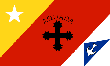
Aguada (literally: water-station or to water) - The shield of Aguada is the seal that the Municipal Government officially uses. It was given to the "Villa de San Francisco de Asis de la Aguada" by the Royal Bill of Grace of January 14, 1778, by King Charles III. With it, they recognized the personality of the "Villa" as part of the Island of San Juan Bautista de Puerto Rico. It carries then symbols of history, religion and culture. The cross, with the interlaced arms of the Redeemer and our Father Saint Francis, signifies the badge of the Order of Lesser Frays of San Francisco, which means: "peace and fraternal hug between man and the Redeemer". The sun below the cross symbolizes the light that brightens the world. He who believes in Light and in Truth shall not be blind forever. The lower part of the shield consists of five Columbine ships that symbolize the second voyage of Christopher Columbus, who arrived to our island on November 19, 1493, by the "Guaniquilla' coast, where he calmed his thirst in the Aguada wells. (Very contested, but probably the most plausible site of the actual landing). The mural crown in the upper part of the shield signifies the title "Muy Leal Villa" (very loyal village), that was given to this town by King Charles III, in the Royal Bill of Grace of January 14, 1778. The official colors of the shield are: red, which stands for the fraternal love that kindles all Aguada; gold stands for the Spanish royalty in Puerto Rico; green stands for our land's hope and fertility; black's the beam that redeemed the world; blue's the sky and the kingship of the Creator; white's the Redeemer's purity and the purity of our people toward the cultural patrimony.
Coat of Arms of Aguada
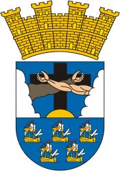
The coat of arms was given to the city by the Royal Bill of Grace of January 14 1778, by King Charles III. With it, they recognized the unique identity of the "Villa" as part of the Island of San Juan Bautista de Puerto Rico. It carries then symbols of history, religion and culture. The cross, with the interlaced arms of the Redeemer and our Father Saint Francis is taken from the badge of the Order of Friars Minor. It represents the motto "Pax et Bonum" -- peace and good will between man and the Redeemer. The sun below the cross symbolizes the light that brightens the world. The lower part of the shield consists of five Columbine ships that symbolize the second voyage of Christopher Columbus, who arrived at the western "Guaniquilla" coast on November 19, 1493 to gather water. Although the precise location is disputed, the Aguada wells is a plausible site for the actual event. The mural crown in the upper part of the shield signifies the title "Muy Leal Villa" (very loyal village), that was given to this town by King Charles III, in the Royal Bill of Grace of January 14, 1778. The official colors of the shield are: red, which stands for the fraternal love that kindles all Aguada; gold, for the Spanish royalty in Puerto Rico; green, for the island's hope and fertility; black, for the wooden beam of the cross that redeemed the world; blue, for the sky and the kingship of the Creator; and white, for the Redeemer's purity and the purity of our people toward the cultural patrimony.
Anthem
The anthem was written by Rolando Acevedo Lorenzo.
The title is Muchos siglos han pasado...
Education
There are 22 public schools in Aguada, education is handled by the Puerto Rico Department of Education.
Demographics *
Population
38,136
Land Area: 30.85 sq mi
Density: 1,209 per sq mi
Median Age: 43.6
Sex: 51% female
Economics **
$10,001
Median household income: $16,802
Puerto Rico: $21,058
Persons below poverty line: 48.4%
Housing, families and educational attainment *
Number of households
13,005
Housing units density:
591.8 (2013)
Persons per household: 2.86
High school grad or higher: 65.9%
Marital status: 43% married
* U.S. Census Bureau 2020 data, unless otherwise noted - Source: Quick Facts Puerto Rico.
** U.S. Census Bureau 2016-2020
Map References
Coordinates: 18.3794° N, 67.1883° W
ZIP Code: 602
Driving Distance from San Juan: 91 miles
Driving Time: 2 hours, 16 minutes
Did You Know?
The oldest city in the United States is St. Augustine in Florida, that is according to a continuously settled Europeans in the city. But the United States jurisdiction recognises San Juan as the oldest city in the US territory of Puerto Rico.
This is your comprehensive guide to La Isla del Encanto.